The Mountain Institute
Avy One : Team Member Awareness
This three-day, primarily field-based course, will introduce students to the knowledge and skills necessary to become a valuable team member in avalanche terrain. Our instruction aims to empower students to have excellent situational awareness and successfully support their team throughout the mission at hand. Military teams are increasingly operating in alpine environments, and avoidance of avalanche terrain is not always an option. To ensure the likelihood of success, each team member needs to be proficient, confident, and an active participant in the decision-making process. Developing this proficiency and confidence takes time, and experience, in a variety of environments. An Avy One provides a structured step-by-step progression, with ample field time, that allows students to develop a strong foundation.
After successfully completing this course, students will:
- Understand the fundamentals of where and why avalanches occur.
- Understand the fundamentals of how the snowpack develops, how environmental conditions affect snowpack structure, snowpack red flags.
- Understand the fundamentals of avalanche mechanics.
- Effectively use navigational tools for route planning.
- Be able to perform a trailhead check.
- Actively participate in goals-terrain-hazards route briefs.
- Use navigational tools to orient to terrain, and navigate in the field.
- Clearly communicate route plans, and potential terrain hazards with others.
- Have insight into the effect of human factors and military operational pressures on decision-making.
- Be aware of the operational risk management process.
- Proficiently perform companion rescue skills.
- Recognize key snowpack, terrain, and weather observations, and apply in real time.
- Understand and perform simple snowpack tests.
- Actively participate in daily debriefs
A typical flow for the course.
Day One: Morning = Classroom & afternoon = Intro to avy rescue
Day Two: All day in the field
Day Three: Morning = Half day in the field & afternoon = Classroom
Avy Two : Alpine Lead
This four-day, primarily field-based course, will introduce students to the knowledge and skills necessary to become capable of acting in a leadership role with a small team in avalanche terrain. The goal of this course is to empower students to interpret data related to the snowpack and weather, make informed route planning decisions, make field observations and apply that information in real-time, and fully support the team to facilitate mission success.
After successfully completing this course, students will:
- Be adept at finding available seasonal weather history for the target location/environment.
- Be able to locate, understand, and interpret the local avalanche advisory and apply that information to a specific mission.
- Run a daily goals-terrain-hazards route brief.
- Instruct others on how to perform a trailhead check.
- Instruct others on avalanche gear use and maintenance.
- Have a functional knowledge of fundamentals of snowpack structure.
- Identify and classify red flags in the snowpack.
- Have a functional knowledge of fundamentals of avalanche mechanics.
- Be familiar with the operational risk management process.
- Formulate and communicate appropriate travel techniques for small to medium sized groups.
- Have insight into the impact of human factors and military operational pressures in decision-making.
- Be familiar with the operational risk management process.
- Have the skills to successfully perform single and multiple burial rescues.
- Have the skills to direct an avalanche rescue.
- Demonstrate the ability to perform snowpack, terrain and weather observations, interpret and apply that information to the task at hand.
- Run a daily debrief
A typical flow for the course.
Day one: Classroom & avalanche rescue refresher. + Multiple burial practice.
Day two: All day in the field/
Day three: Half day in the field & afternoon classroom.
Day Four: Student-led, all day in the field.
Avy Rescue (MFR)
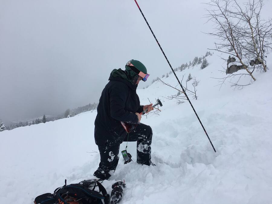
This one-day field-based course is designed for all levels, from novice to backcountry veterans. This training takes place on slopes, not flat ground. We will cover the knowledge and skills required to rapidly and effectively conduct, and direct, a companion rescue. This proficiency is best obtained with methodical instruction followed by hands-on practice in a high-fidelity simulation environment.
After completing this course, students will:
- Understand how to use avalanche rescue gear
- transceiver, shovel, probe
- Understand how to select and maintain avalanche rescue gear.
- Be able to perform a trailhead check.
- Expeditiously perform a signal, coarse and fine beacon search.
- Effectively pinpoint with an avalanche probe.
- Execute effective shoveling techniques, solo and with a group.
- Be able to perform a rapid solo recovery of one buried avalanche transceiver.
- Be able to perform a rapid solo recovery of two buried avalanche transceivers.
- Be able to direct a team during an avalanche rescue scenario.
- Use common terminology to effectively describe avalanche anatomy and terrain to others.
- Demonstrate techniques for locating buried individuals without a beacon.
- Be familiar with common avalanche victim injuries, and immediate treatment.
- Understand how to request and facilitate evacuation, and additional rescue and medical resources.
This class is fun, you will be moving all day!
Backcountry Navigation
Continuing education. This course is best for those who have taken at least level one (but not required) and are still looking for the next thing. There is only so much time in a 3 or 4-day course to cover everything. Terrain is everything and digital tools are here to stay. This course focuses on modern, digital navigation techniques and most of all, terrain analysis. 3 hours on Zoom with a max of 3 students. It will be the most interactive Zoom class you have ever taken.
This class can also be organized for in person groups of up to 12.
After completing this course, students will:
- Be familiar with modern digital mapping tools
- know how to perform a detailed terrain analysis
- be able to reference a military-style navigational checklist
- communicate and plan a day in the mountains by looking at a map together.
- Share .gpx files of routes, tracks, and areas.
- know how to save things for offline use.
- be able to make solid plans from point A to B to C
This course of instruction is traditionally 100% online but can also be taught to groups in person, upon request.
The online class is a max of 3 students at a time for 3 hours.
It requires a good working laptop or computer with solid internet access.
Those who struggle with technology are encouraged to book a private 1 on 1 class or a multi-day class with their friends.
